
It looks like a very BIG road.
NELA has released (northeastlink.vic.gov.au) the latest information on the NEL
The effect on open space in Whitehorse is not very clear since, very unfortunately for residents, detailed maps showing the new road overlay are not provided.
Some artists impressions of various parts of the new road arrangements are shown. Overlaying one of these looking west from Surrey Rd Nth. Blackburn onto a Google Map photo, “before and after” photos can be created as below.
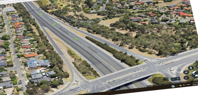
BEFORE
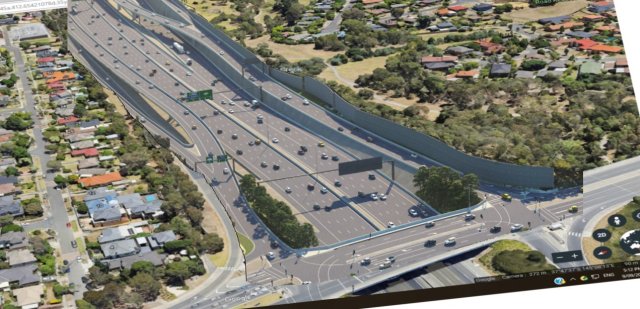
AFTER
It looks like a LOT of new road, and it all has to come from present open space.
And virtually all that new capacity will head south through Whitehorse – much of it in the direction of Box Hill which is already becoming more congested due to the unprecedented building boom there.

